
START WITH THE DECISION
What do you need
your map to tell you?
A plantation inventory. A terrain model. A clearer record of construction progress.
Aerofleye helps define the capture method and deliverables around the information your team needs. We begin with the area of interest, intended use and quality requirements, then scope the mission, processing and handover.
The aim is straightforward: data your team can interpret, work with and act on.
CHOOSE THE RIGHT DATA
Three capture methods.
Different questions answered.
01/ RGB PHOTOGRAMMETRY
Map what is visible.
Overlapping aerial photographs support orthomosaic maps, surface models and visual site records.
- Plantation and property overview
- Construction progress documentation
- Visible tree inventory and asset locations
- Stockpile and surface modelling
Best suited to visible surfaces. Vegetation can obscure the ground below.
02 / LiDAR MAPPING
Understand the terrain.
Laser scanning supports three-dimensional point clouds and terrain extraction where suitable ground returns are captured.
- Terrain and elevation assessment
- Infrastructure corridor planning
- Vegetated-site evaluation
- Classified point-cloud deliverables
Ground detail depends on canopy conditions, capture design and classification quality.
03 / MULTISPECTRAL MAPPING
Explore vegetation variation.
Multispectral imagery supports vegetation indices such as NDVI and NDRE to help prioritise field investigation.
- Plantation and crop variability
- Areas for targeted field checks
- Turf and golf-course monitoring
- Repeat observations over time
Index differences need field context. They do not, on their own, diagnose a disease or nutrient deficiency.
FROM CAPTURE TO HANDOVER
Outputs built
for your workflow.
Select the required outputs before capture.
Formats and quality criteria are agreed in the proposal.
Deliverable | Example formats | What it support |
RGB Orthomosaic | Georeferenced site overview and visible-feature interpretation | GeoTIFF / PDF layout |
LiDAR point cloud | Three-dimensional analysis and classification workflows | LAS / LAZ |
Terrain & surface models | Elevation analysis; DTM for ground, DSM for the visible surface | GeoTIFF / agreed CAD export |
Contours & site features | Planning layers at an appropriate interval and level of detail | DXF / GeoPackage |
NDVI / NDRE maps | Vegetation variability and prioritised field inspection | GeoTIFF / PDF report |
Tree count & inventory | Mapped tree positions and a reviewed inventory within agreed detection limits | CSV / SHP / GIS point layer |
GIS map & findings report | Organised spatial layers, methodology, findings and limitations | GeoPackage / KML/KMZ / PDF |
Illustrative deliverable options; inclusion depends on the selected capture method and project scope.
PLANTATIONS & AGRICULTURE
Know your area.
Locate your trees.
Target your fieldwork.
Combine a plantation overview with the information that matters to management: tree locations, accessible features, block-level observations and areas requiring closer inspection.
01/ Tree count & locations
Scope tree detection and review around species, crown visibility, spacing and imagery resolution. Agree validation and treatment of uncertain detections.
02/ Farm & block mapping
Organise agreed block boundaries, tracks, drains and other visible features into practical GIS layers.
03/ Vegetation observations
Add multispectral analysis when it serves a defined agronomic question. Pair mapped variation with field observations.
APPLICATIONS ACROSS INDUSTRIES
A shared view.
Better-informed teams.
Explore the proposed application portfolio below. Project scope and deliverable are confirmed on enquiry.
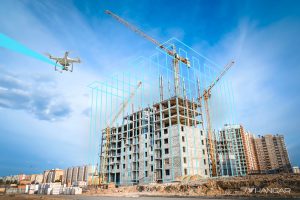
Construction & development
Site baselines, progress records and surface information for project coordination.
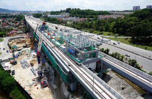
Infrastructure & utilities
Corridor context, terrain information and mapped features to support further assessment.
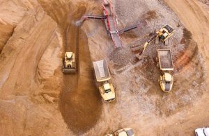
Quarries & stockpiles
Surface modelling and volume estimates using an agreed reference surface and method.
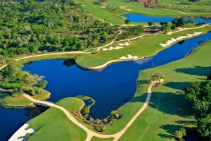
Golf courses & managed landscapes
Site inventories and vegetation variability to guide inspection and maintenance planning.
THE AEROFLEYE APPROACH
Define the requirement.
Verify the result.
01
Scope
Confirm the site boundary, intended use, resolution, accuracy and deliverables.
02
Plan & capture
Assess access, terrain and flight constraints; confirm permissions and the capture plan.
03
Process & review
Process imagery or point clouds, check coverage and assess the outputs against agreed criteria.
04
Deliver & explain
Provide the agreed files, methodology and limitations with a findings discussion.
BEFORE YOU COMMISSION
Practical questions.
Do I need RGB, LiDAR or multispectral?
Start with the decision the data must support. RGB is useful for visible site detail; LiDAR can support terrain extraction where ground returns are available; multispectral data helps assess vegetation variation. A combined scope may be appropriate.
Can you count coconut or other plantation trees?
Tree counting can be scoped around species, crown visibility, spacing, terrain and the intended inventory. Overlapping crowns, young plants and obscured trees may need additional review or field validation.
How much does a survey cost?
Pricing depends on location, area, terrain, access, capture method, control requirements, processing and deliverables. Share a site boundary and intended outputs for a project-specific proposal.
How long will delivery take?
The programme depends on permissions, weather, mobilisation, capture and processing scope. A proposed schedule is included once the site and deliverables have been reviewed.
Can a drone map establish my legal property boundary?
An aerial map can show visible features and supplied boundary information. It does not independently establish legal ownership or replace a cadastral boundary survey. Confirm any professional survey requirements for the intended use.
Can surveys be repeated to track change?
Yes, repeat surveys can be scoped with consistent capture and processing methods. Comparability depends on the control, resolution, season, illumination and other relevant conditions.
START WITH YOUR AREA OF INTEREST
Let’s put your site
in perspective.
Send a marked map, KML/KMZ boundary or coordinates, and tell us what you need to measure or understand.
Request a technical & commercial proposal.
Include the approximate area, site location, required outputs and intended timeframe.